Discover The Power Of Our Software Applications For Subdivision Design
Subdivision Design is complex with many moving parts and changes during the course of planning and design. Use our software to accelerate civil design workflows, streamline construction documentation, and quickly respond to changes.
Examples of Subdivision Design projects and tasks our apps make better:
- Initial design of all roads
- Curb returns
- Turning lanes
- Bus bays
- Cul-de-sacs
- Islands
Our software applications seamlessly integrate with:
Key Features Used For Subdivision Design Projects

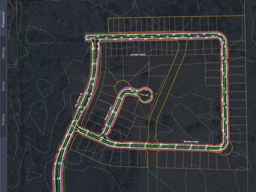
Fast and Effective Road Network Design for Subdivisions
Civil engineers typically receive a subdivision layout as a series of CAD entities defining lots, edge of pavement, back of curb, turning lanes, bus bays and islands.
Traditional civil design tools such as Civil 3D require designers to manually create alignments, assemblies, profiles and intersections ultimately leading to corridor creation. All changes required moving back and forth updating intersections manually as changes are made to profiles.
This process is time consuming for experienced designers and often incomprehensible to interns and junior designers!
Civil Site Design Provides the Automation and Intuitive User Interface to Simplify This Process
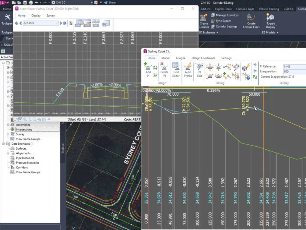
Civil Site Design (CSD), a plugin to Civil 3D, and add-on to BricsCAD allows users at all skill levels to generate a complete road network design in minutes. You skip the tedious, mundane tasks and get immediately to actual detailed design.
Working with your existing ground surface and road centerline alignments CSD will:
- Create a road with best fit vertical design by selecting the alignment, the template and the target surface
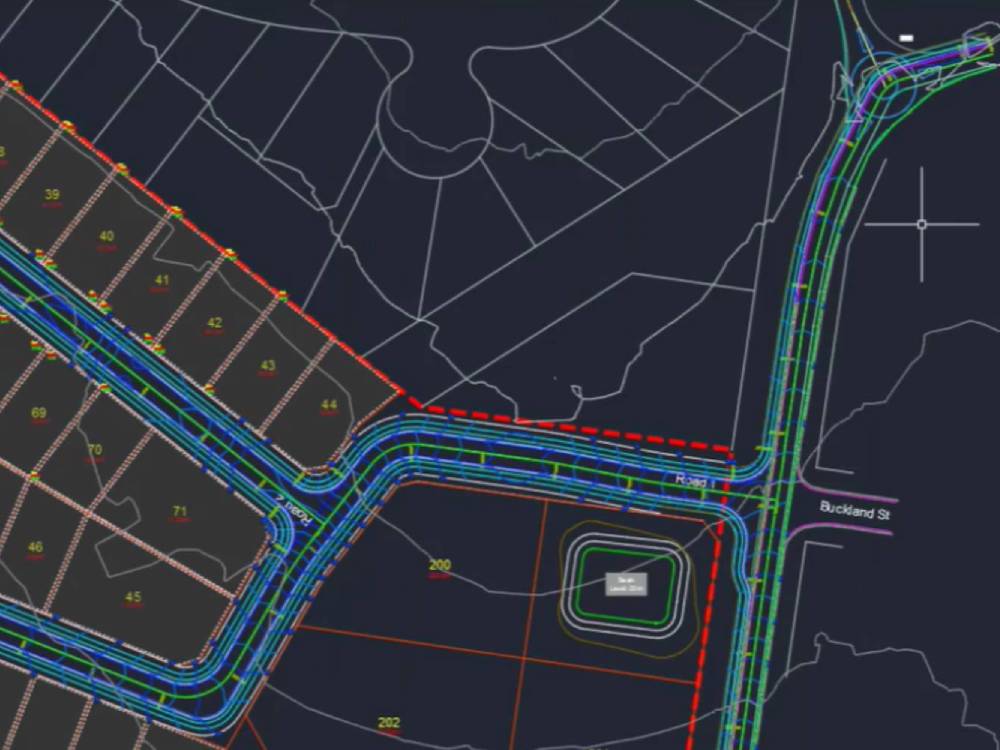
- Automatically create all roads if you so choose. In plan view, the horizontal geometry is displayed and the individual profiles are ready for editing
- Automatically generate all curb returns tied directly to the associated roads. A complete, dynamic model that automatically updates as profiles are edited – eliminates the need for the curb return editor
- Create parametrically driven Cul-de-sacs with support for circular, asymmetric, tear-drop, Y and T shaped configurations. After setting the values CSD will lay it out horizontally and vertically to match the incoming road and with cross sections automatically matching the road at either end.
What can take hours of effort in Civil 3D is completed with Civil Site Design in minutes.


Take it to the Next Level of Automation with Project Assist – the AI Expert in Civil Site Design
Project Assist takes road network design to the next level of automation. Again working with simple polylines users can name their alignments with design intent. For example, turning lane, bus bay, widening, parking bay, boundary etc.
When activated, it will read all alignments, provide you with a list and suggested design intent. Once confirmed a detail list of each alignment is presented where users can fine tune the intent, assign templates to roads, add cul-de-sacs and define model in islands which creates a new model with the islands draped over the initial road surface.
If you are using Civil 3D, Civil Site Design will create your:
- Civil 3D model surface
- Generate all profiles using your styles
- Create assemblies based on the templates you used
- Create your corridor for you
Keep what you like about Civil 3D – Upgrade the Rest
More Features Used For Subdivision Design
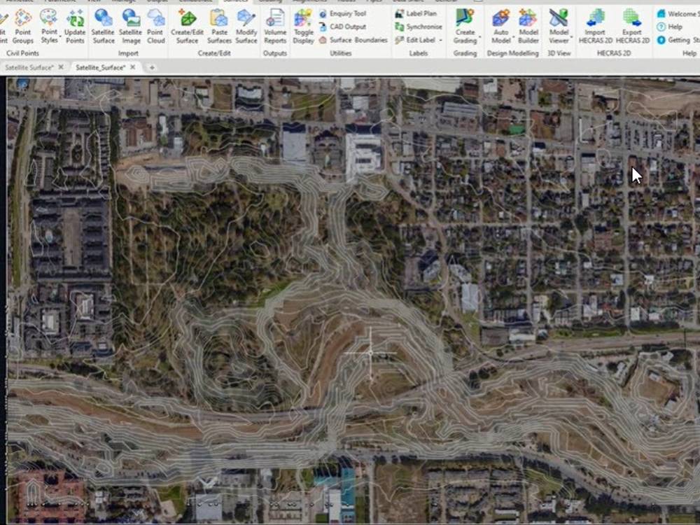
- Ability to import Google images and surface data for pre-design analysis
- Easily create templates for road design – no need to use the assembly builder
- Automatically generate roads and intersections which are dynamically connected
- Powerful Vertical Grading Editor provides an intuitive interface for profile editing with direct access to cross section views
- Automatically balancing of cut and fill along a road segment
- Automatically building out an entire road network the the AI tool Project Assist
- Gravity pipe design with a visual editor to simplify the design process
- Dynamic grading tool that updates with simple grip edits
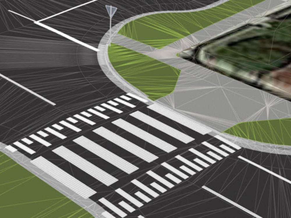
- Model Viewer – a 3D rendered visualization tool that updates dynamically as design changes are made
- Leveraging the powerful lidar processing tools now built into BricsCAD Pro.
- Civil 3D users find Civil Site Design adds several missing features that speed up throughput and remove errors by eliminating tedious workarounds while maintaining your production standards.
Civil Survey Application software can offer several benefits for civil projects, such as:
Increased efficiency: Civil survey software can automate many time-consuming tasks, such as creating and updating maps, calculating volumes, and generating reports. This automation can save time and reduce errors, allowing engineers and surveyors to focus on more critical tasks.
Improved accuracy: Civil survey software can use advanced algorithms to produce more accurate measurements and models. This increased accuracy can help ensure that projects are completed correctly the first time, reducing the need for costly rework.
Better collaboration: Civil survey software can facilitate better collaboration between different stakeholders, such as engineers, surveyors, and contractors. This collaboration can help ensure that everyone is working from the same data and can help identify and address issues early in the project.
Enhanced visualization: Civil survey software can provide 3D visualization tools that allow engineers and surveyors to better understand complex designs and communicate them more effectively to stakeholders.
Compliance with regulations: Civil survey software can help ensure compliance with local regulations and standards by providing tools for mapping and monitoring construction sites, monitoring environmental impacts, and generating reports required by regulatory agencies.
In summary, civil survey application software can help streamline civil design workflows, improve accuracy, facilitate collaboration, enhance visualization, and ensure compliance with regulations. However, it’s essential to evaluate the specific needs of your project and choose the right software to fit those needs.

